Thompson, Lonnie G. (1948-����) is an important figure in the history of
water because as a glaciologist he has targeted the long-neglected ice
fields of the tropics. His work provides critical information which illuminates some of
environmental causality behind the
life cycles of prehistoric and historic civilizations. In 2001, because of his innovative
work, Thompson was named by CNN and Time magazine as one of America's
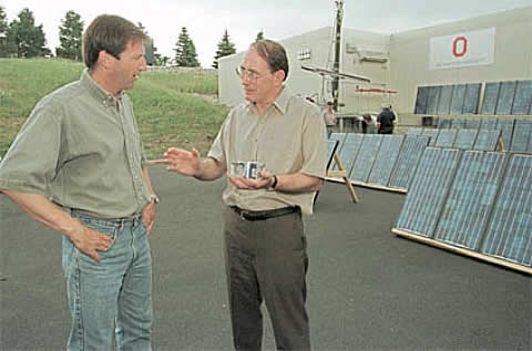
best scientists (see Photo 1).
Born in 1948, Thompson grew up in rural Gassaway,
West Virginia, and he views his family's struggle to eke out an existence on a small
farm as a source of personal strength. Among other things, that strength has
helped inure him to the physical hardships--frostbite, altitude sickness,
barely palatable food--that he routinely endures during his field work.
Thompson won a scholarship to West Virginia's Marshall
University, majored in geology, then enrolled at Ohio State with the intention
of becoming a coal geologist. But while working on his master's degree, he took
a research job that put him in contact with the first ice core ever retrieved from
Antarctica. To his surprise, he developed an interest in reconstructing
Earth's climatological history from the dust particles, pollen grains and subtle geoclimatical
shifts trapped in the core's layers.
This interest has lead Thompson to collect and interpret a varied assortment
glatial records. Recently he studied the snow-clad ice fields
of Kilimanjaro and the ice pack of the Himalayas. In the 1980s he
worked on the Quelccaya ice cap in southern Peru, reconstructing a 1,500-year
sequence of swings from wet to dry that eerily track the rise and fall of ancient
adjacent civilizations (ie. Tiwanaku).
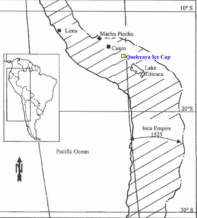
The Quelccaya ice cap is located in the Cordillera Oriental mountain range
approximately 200 km northwest of Lake Titicaca (see Fig. 1).
During the 1980s, Thompson and
his colleagues drilled and analyzed cores from the ice cap. Their work has provided
a record of the climate dating from 500 AD to 1984 AD (see Fig. 2).
Like layers in a cake,
each slab of the ice reveals yearly accumulations of ice along with dust
particles and oxygen isotopes. A layer's thickness represents yearly precipitation.
The oxygen isotope is a guide to temperature. Dust from parched
agricultural fields is blown by the wind, some of it settling on the glacier.
Fig. 1. Map showing the location of Quelccaya ice cap, located midway between Cusco and Lake Titicaca.
 | Click on the image for a larger version. |
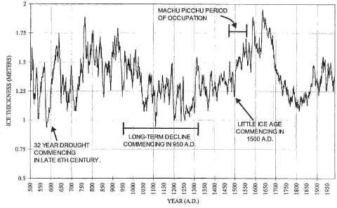
Fig. 2. Quelccaya Ice Cap record illustrated as 10-year moving average for 500-1984 A.D. period.
| Click on the image for a larger version. |
In recent years, Thompson has been consumed not only
with the dramatic shift
that has occurred in the distant past but also by those that are so clearly taking
place now. In 2001, Thompson unveiled compelling evidence that ice across the
tropics is disappearing at an unprecedented rate. Kilmanjaro, he reported, has
80% less ice cover today than it did in 1912; a third of that loss has happened
within the last decade. The Quelccaya ice cap is also receding at an alarming
clip and may disappear entirely by 2020.
 | Sources |
|---|
| | Nash, J. Madeleine, 2001. "The Iceman", Time, August 20, pp. 42-43. Thompson, L. G., et.al., 1989. "A 1500-year record of tropical precipitation in ice cores from
the Quelecaya ice cap, Peru," Science, 229 (4717), pp. 971-973. |